Official Government Website

Project Reports
Model Overview
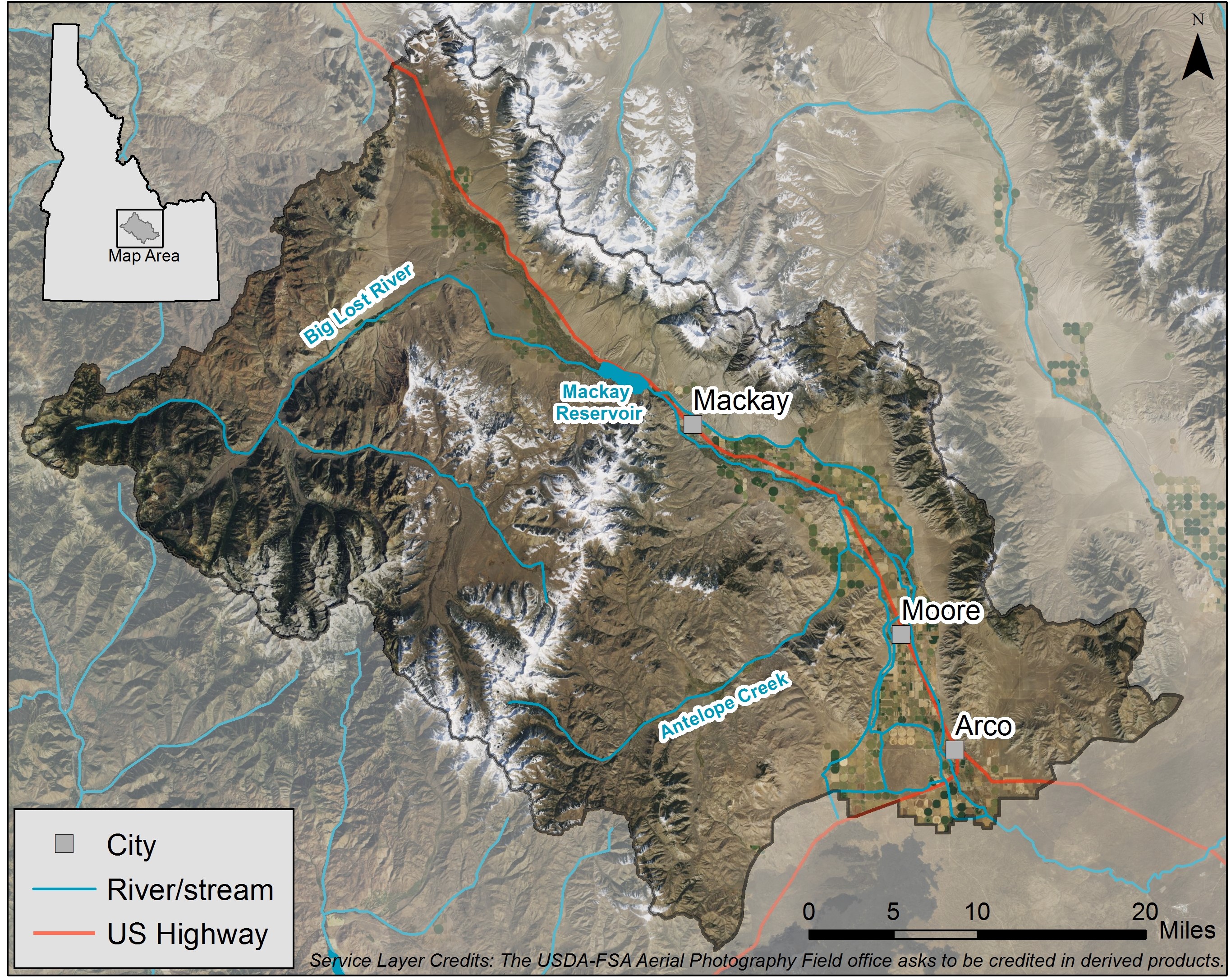
The U.S. Geological Survey (USGS) is developing a groundwater flow model for the Big Lost River Basin to help answer questions arising from concerns over water resources and to provide a tool for water resource management.
The project is a collaboration between the USGS, IDWR, and IWRB with involvement from stakeholders through the Model Technical Advisory Committee (MTAC). Each entity fulfills a distinct role in the model development process. The USGS is responsible for model construction, calibration, and report preparation; IDWR is the end user, facilitates MTAC meetings, and provides modeling support; the MTAC provides a platform for stakeholder input and review on the model, scenarios, objectives, and shares data required for the model; and the IWRB provides financing via the Aquifer Planning and Management fund.
Final model rollout is scheduled for June 2025.
Development Approach
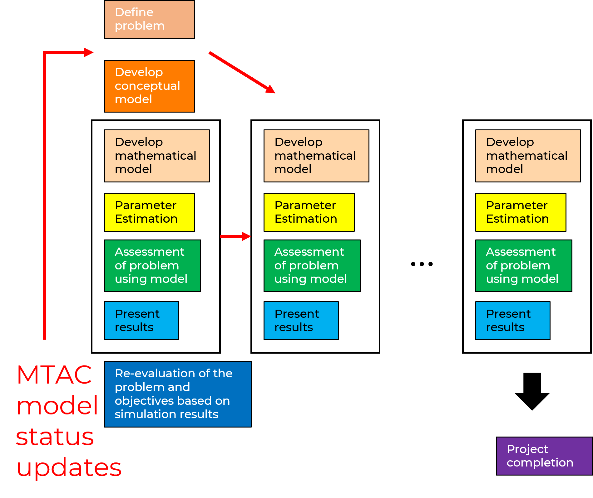
The USGS proposed an iterative and incremental approach to model development in which a minimum viable product (MVP) model is constructed from the onset of the project. As a conceptual and numerical model is discussed and refined, model structure is updated, and the model calibrated to reflect these changes. The flowchart illustrates the steps in this iterative process.