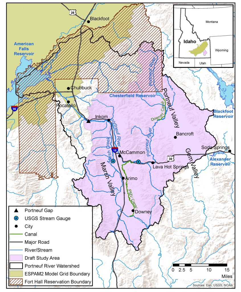

The Portneuf River Basin is located in southeastern Idaho. Notable geographic features in the area include the city of Pocatello, part of the Fort Hall Reservation, which overlaps with the northernmost area of the basin, and the American Falls Reservoir at the farthest northwest extent of the basin. The basin is tributary to the Snake River and the Eastern Snake Plain Aquifer (ESPA). The prominent surface water drainages for the basin are the Portneuf River and its largest tributary, Marsh Creek.
Groundwater and surface water are dynamically interconnected within the basin, and recent studies have found evidence of declining groundwater levels since the development of groundwater for irrigation. The basin is currently under a moratorium order established in 2022 which prevents further appropriation, with minor exceptions, of surface and groundwater resources. A need exists for IDWR to collect contemporary and complete information on groundwater and surface water resources of the Portneuf River Basin to better inform decision-making for stakeholders.
Beginning in 2023, IDWR and the Idaho Water Resource Board (IWRB) began a project to characterize the surface and groundwater hydrology of the Portneuf River Basin. The following tasks are planned for the project:
- Develop a conceptual hydrogeologic framework
- Develop groundwater budgets
- Conduct groundwater level mass measurement events
- Install streamgages and perform multi-year seepage studies to examine surface water-groundwater interactions