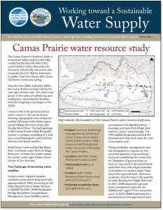
The Camas Prairie is an intermountain basin located in south-central Idaho. The basin is bounded by the Soldier Mountains to the north, the Bennett Mountains to the south, and the South Fork Boise River divide to the west. Camas Creek drains the basin as it flows east into the Big Wood River at Magic Reservoir.
In 1991, IDWR designated the Big Wood River Ground Water Management Area (GWMA), which includes the Camas Prairie and the Big Wood River drainage upstream from Magic Reservoir. This GWMA was established to address the connection between ground and surface water within the Camas Creek, Silver Creek, and Upper Big Wood River drainages above Magic Reservoir, and to protect senior surface water users from reduced flow due to junior groundwater pumping.
Beginning in 2023, IDWR and the Idaho Water Resource Board (IWRB) initiated a project to characterize the surface and groundwater hydrology of the Camas Prairie. To date, IDWR has partnered with the USGS to complete the following objectives:
- Develop a conceptual hydrogeologic framework for the study area
- Develop a groundwater budget for the aquifer and a water budget for Magic Reservoir
- Conduct groundwater level synoptic events
- Perform borehole geophysics on newly drilled wells
In addition to the work outlined above, IDWR intends to complete additional tasks such as collecting streamflow measurements, drilling new monitoring wells, and enhancing the current groundwater level monitoring network.
An open house meeting was held in September 2024 to inform the public on the status of the project. Please click here to access the presentation slides.


