Northern: (208) 762-2800 Western: (208) 334-2190 Southern: (208) 736-3033 Eastern: (208) 525-7161
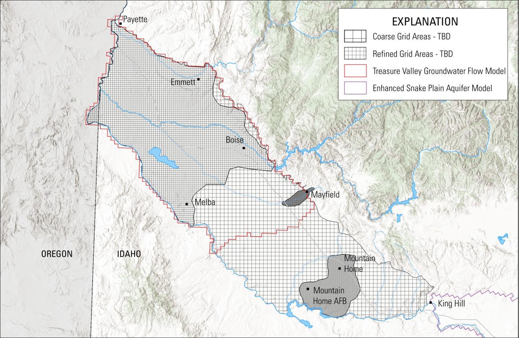
The U.S. Geological Survey is developing a transient numerical groundwater-flow model of the western Snake River Plain.
More details will be added as we develop the project page.


 Official Government Website