
Geothermal Resource Wells Overview
Heat energy from the earth is considered a “green” source of energy because it is renewable and does not emit carbon like the usage of fossil fuels. Over 200 springs and more than 1,000 wells producing naturally-warmed waters are evidence of Idaho’s abundant renewable energy resources. These valuable resources are currently being used in Idaho for both Direct Use (the heating of public buildings, homes, and greenhouses, and the raising of fish and other aquatic species) and Power Generation.
Geothermal Resource Wells
Wells in Idaho with a bottom hole temperature of 212 degrees Fahrenheit or more are classified as a geothermal resource well. IDWR, under authority granted by the Idaho Geothermal Resources Act, regulates drilling, operation, maintenance, and abandonment (decommissioning) of all geothermal resource wells in the state.
Low-Temperature Geothermal Resource Wells (LTG)
Wells in Idaho that have a bottom hole temperature more than 85 degrees F and less than 212 degrees F are designated as low-temperature geothermal (LTG) resource wells. LTG wells are used primarily for the heat value and secondarily for the water value. Owners of a LTG well are required to file with IDWR a bond ranging from $5,000 to $20,000 depending on the depth of the well. The well owner bond remains in effect for one year following the completion of the well. To drill and construct LTG wells, drilling companies must maintain with IDWR a $20,000 bond.
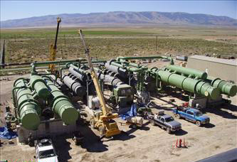
Geothermal Well Construction
Geothermal sources are typically much deeper than cold water aquifers used for domestic purposes and agricultural irrigation. Due to the pressure, temperature, and depth of geothermal resources, wells drilled for the exploration and development of geothermal resources must meet more stringent construction standards than a typical domestic or irrigation well. Construction standards for geothermal resource wells require casing and sealing through the shallower groundwater aquifers to prevent mixing that could impact the quality of potable water sources and damage the geothermal resource. Exploration and development of geothermal resources are regulated under the Idaho Geothermal Resources Act and IDAPA 37.03.04.
Drilling a geothermal well in Idaho requires a well construction permit. Specific regulations apply to the drilling of geothermal wells in order to protect both the geothermal resource and any overlying cold water resources.
Geothermal Resource Wells Management
Monitoring
Monitoring of geothermal resources is currently being conducted in four major areas:
Monitoring data collected often include wellhead pressure and temperature, flow rates, and totalized flow. In the past, geochemical data were collected at many of the hot springs and wells.
Research & Maps
Management of Stressed Geothermal Aquifers
Declining wellhead pressures and water levels caused IDWR to issue orders restricting additional geothermal withdrawals in the Boise Front and Twin Falls County areas. In the 1980s, three geothermal Groundwater Management Areas were established as a result of these stresses:
- Banbury Hot Springs Area
- Boise Front Low Temperature Geothermal Resource Area
- Twin Falls Geothermal Resources Area
Additional restrictions were put in place in the Boise Front and Twin Falls areas through Department-issued Moratoriums. Also, Groundwater District 63-S was established in 1989 for the Stewart Gulch area, which is a subset of the Boise Front GWMA, and is located about six miles to the northwest of downtown Boise.
Geothermal Resource Wells Resources
Rules & Statutes
Administrative Rule
IDAPA 37.03.04 – Drilling for Geothermal Resources Rules
Statute
Idaho Code § 42-4001 et seq. – Geothermal Resources Act