Official Government Website

Science Behind Cloud Seeding

What is cloud seeding?

Cloud seeding is a form of weather modification that increases the efficiency of a cloud by enhancing its natural ability to produce ice. When an ice particle first forms, it will collide with other water molecules and continue to grow, until the ice particle becomes heavy enough to fall as precipitation in the form of rain or snow. 

Why are clouds seeded?

Cloud seeding authorized by the Idaho Water Resource Board (IWRB) is used during the cold season to augment high elevation snowpack, a critical source of water supply for the state. Cloud seeding is also used in other areas of the US and around the world, for rain enhancement during warm seasons, for hail mitigation to reduce damage to crops and infrastructure, and for fog suppression.

Enhancement of winter snowpack ultimately results in increased runoff, and thus, the availability of water to support the unique needs of each basin or region.    

Benefits of Increased Water Supply Include:

  • Increased water availability for:
    • Aquatic habitat
    • Water Quality 
    • Reservoir Storage
    • Flow augmentation
    • Natural Flow Water Rights
    • Aquifer Recharge
    • Hydropower
    • Recreation
  • Extended seasonal flows due to increase of high elevation snowpack
    • Fill of natural flow water rights
    • Reduced dependency on storage water
    • Increased reservoir carryover

What is a cloud?

Clouds are made up of water vapor (gas), tiny water droplets (liquid water), and ice particles (frozen water) within the atmosphere. Water molecules can take many forms depending on the atmospheric conditions. Water molecules commonly become “supercooled” in colder and/or mixed phase clouds due to the surrounding temperatures.

There are three types of clouds:

  • All Liquid clouds: exist entirely of liquid water molecules at temperatures of 14 to 23 F
  • Ice-Crystal clouds: exist entirely of ice crystals (such as a cirrus cloud)
  • Mixed-Phase clouds: made up of both liquid AND ice (“Mixed”); have some portions with temperatures 14 to 23 F and include all regions with 32 F.

What is supercooled liquid water (SLW)?

At standard pressure, water freezes at 32 degrees Fahrenheit. However, under the right conditions, liquid water can exist at temperatures below freezing temperatures (below 32 degrees F). This liquid water is called “Supercooled Liquid Water” (SLW). This form of water is one of the most common states of water in clouds. SLW can freeze into solid form (ice) instantly if the SLW is physically disturbed. When SLW comes in contact with a surface, it will freeze on contact, creating a particle of ice that will grow in size as it collides with other SLW molecules. When the ice particle becomes heavy enough, it falls from the sky as precipitation. Precipitation occurs naturally as a result of impurities such as dust, smoke, and aerosol particles that exist within the atmosphere, creating a nucleus for ice formation. 

Try this at home! 

How does a cloud form?

Clouds form when invisible water vapor in the air condenses into visible water droplets or ice crystals. When air rises, it expands and cools when temperatures drop rising into the atmosphere. As this happens, the relative humidity (RH) increases until water vapor (gas) in the air condenses and a cloud is formed. 

Clouds form via four primary atmospheric processes:

Water droplets in clouds first form by condensation. When a cloud droplet reaches a certain size, it begins growing more rapidly by collision and coalescence, growing into larger droplets that fall at varying speeds. This process can be a slow and inefficient process.

Figure 1. Atmospheric lifting processes that form clouds (image provided by Cenage 2012)

How does a snowflake develop in nature?

Figure 2. Diagram showing how ice crystals form in nature (provided by Idaho Power Company)

  1.  A microscopic dust particle is present in a cloud. This acts as the nucleus or “landing pad” for water droplets to freeze and form an ice particle.

  2. Water molecules condense onto the surface of the particle and then onto each other in a hexagonal lattice formation.

  3. The hexagonal platelets grow into a prism. Different “facets” or branches of ice grow at different rates depending on the conditions.

  4. Branching instabilities cause arms to grow on the corners of the structure. These grow faster than the rest of the crystal and become more pronounced.

  5. The crystal is then carried by winds from the storm and will experience varying conditions as it goes, which favors new plate growth again and again, until the particle or snowflake becomes heavy enough to fall from the sky.

    The variability of weather conditions experienced by each ice particle or snowflake accounts for the complexity of forms seen… Thus why “every snowflake is unique!”

What kind of clouds commonly form in the winter in Idaho?

Due to Idaho’s amazing mountain ranges, wintertime “orographic clouds” are predominate in the wintertime here in Idaho. The process of cloud formation occurs when moist air moves across the mountain ranges, lifting and condensing moisture to form a cloud. In colder winter orographic clouds, less liquid water content is available. There often is not enough liquid in the cloud to grow droplets that will be large enough to fall and produce precipitation. In these colder clouds, liquid water does not necessarily freeze (and turn into ice) at 32 deg F. The liquid is instead Super Cooled Liquid Water (SLW). Many clouds at mid and high latitudes are too cold to produce precipitation from liquid alone. When clouds exist at lower temperatures, they are not efficient at generating ice naturally without some type of particle to initiate the freezing process. 

Therefore, introducing more particles into the atmosphere can enhance the production of precipitation. Seeding agents can be introduced into the cloud to create more “landing pads” for SLW to attach and form ice; and they can do so at warmer temperatures (beginning at 23 F) than naturally occurring ice. Clouds that contain an abundance of supercooled liquid water (SLW) are prime candidates for cloud seeding. 

Figure 3. Diagram of a winter orographic cloud (provided by the Weather Modification Association)

How does cloud seeding work?

Figure 4. Diagram showing points at which water molecules can form ice on a particle

Cloud seeding is a physical process whereby a seeding agent comprised of minute particles is released into an EXISTING cloud formation with Supercooled Liquid Water (SLW). These particles provide a surface (nucleus, or a “landing pad”) for the SLW molecules to bond and formulate ice particles. Water molecules freeze on contact with the particles and begin to grow into a snowflake as it encounters other water molecules, until the snowflake reaches a density heavy enough to fall to the ground as precipitation. This occurs naturally as a result of impurities in the atmosphere such as aerosols and dusts present in clouds. Seeding essentially provides more “landing pads” for SLW to freeze upon, mimicking physical processes of precipitation that are occurring naturally.

What seeding agent is used?

Figure 5. Silver Iodide chemical compound structure (image courtesy of WebElements.com)

Silver Iodide (AgI)

Silver Iodide (AgI) is the most common seeding agent used to conduct cloud seeding. AgI’s molecular structure has the same physical shape (hexagonal) as naturally occurring ice. This incites the growth of ice particles and can be used to generate ice at warmer temperatures than naturally occurring ice. Silver iodide functions at warmer temperatures than naturally occurring ice, allowing for ice formation, and thus precipitation, to begin sooner.

AgI is inert in the natural environment. This means that it is a stable compound and does not react with other chemicals. It is also “insoluble” in water, meaning it cannot “disassociate” or break apart to become free silver (Ag+) available to aquatic organisms. 

With nearly 80 years of cloud seeding operations having occurred worldwide, there remains no evidence of adverse impacts to humans, biological systems, or the environment from use of AgI for cloud seeding. This is largely because of quantities of AgI used, the large geographic areas where its distributed, and the short periods of time under which operations occur. For these reasons, bioaccumulation is unlikely to occur.  

Silver Iodide (AgI) is used for a number of applications beyond cloud seeding. AgI is relevant in the medicine and photography industries. Silver Iodide is used in certain treatments acting as an antiseptic to prevent infections due to its antibacterial properties. Concentrations of AgI used for these purposes typically far exceed those used for cloud seeding. 

Figure 6. Silver Iodide seeding agent in a vial (image courtesy of Webelements.com)

Is AgI water soluble?

AgI is a non-organic chemical compound with a level of water solubility close to that of quartz (white sand). The same white sand one might find on a beach. Quartz is not water soluble, which is why it is the most common mineral found on Earth. AgI, like white sand (quartz), is not water soluble. This means that the minerals in silver iodide will not become free and break apart when in contact with water.

How big is a particle of AgI?

Silver Iodide (AgI) is burned and released into the atmosphere. These particles of AgI are the size similar to that of a smoke particle. These particles are microscopic particles and released in extremely small quantities.

How does the process of cloud seeding work?

Figure 7. Diagram showing the conceptual model of how cloud seeding works (provided by National Center for Atmospheric Research)

  1. Air flows over a mountain forming a cloud that contains super cooled liquid water. Storm systems are monitored by weather instrumentation to ensure that the incoming storm conditions are conducive for cloud seeding operations to occur.

  2. A seeding agent, most commonly Silver Iodide (AgI), is then released into the existing storm cloud by an aircraft and/or by ground-based generators. This process only occurs when the storm system within the region has conditions that are conducive of effective cloud seeding operations. Seeding materials are released during active storms with specific conditions conducive to ice formation, and thus cloud seeding. No existing cloud, no cloud “seeding.”

  3. Seeding materials are dispersed and reach the targeted cloud. The seeding process can occur by injecting seeding material either directly into the cloud or dropping it from above the cloud via airborne seeding; or by dispersing seeding material under certain wind conditions, that will ultimately carry the material up into the cloud.

  4. The silver iodide particles have a similar molecular shape of ice, which provides areas (“landing pads”) for the SLW to freeze and form to. Through this process the SLW forms ice crystals.

  5. Ice crystals grow at the expense of the SLW in the cloud and become large enough to fall and create snow, essentially “wringing out” more water from the cloud before it moves out of the basin or region.

What research has been done to demonstrate it works?

Cloud seeding was first demonstrated in a lab setting in 1946. The idea was to grow ice to form precipitation in a lab setting, hypothetically, that could be applied broad scale to “boost” natural precipitation. Fast forward over 70 years later, and researchers finally got funding to take various weather instruments out into the field in the winter of 2017 and test the conceptual model of cloud seeding.  The Seeded and Natural Orographic Wintertime clouds: the Idaho Experiment (SNOWIE) utilized a full outfitted weather research aircraft to fly directly into clouds and release silver iodide plumes to detect and measure the impacts of seeding. Through a suite of weather instrumentation used both on the ground and on the aircraft, researchers were able to capture a 4-d picture of the atmosphere to study what happened when they introduced cloud seeding. While many smaller scale efforts occurred attempting to assess the efficacy of cloud seeding for purposes of precipitation enhancement, the SNOWIE research project was the first to demonstrate ‘unambiguous’ evidence that cloud seeding can produce winter precipitation.

Figure 8. Radar image showing the effects of cloud seeding in the SNOWIE experiment (provided by National Center for Atmospheric Research)

Figure 9. Legend for the radar image (Figure 7) in the SNOWIE experiment

The Seeded and Natural Orographic Wintertime clouds: the Idaho Experiment (SNOWIE):

The conceptual model of cloud seeding, for winter orographic precipitation enhancement with silver iodide, was demonstrated through the SNOWIE research project. SNOWIE is a National Science Foundation study done in collaboration with the National Center for Atmospheric Research (NCAR), Idaho Power Company, and multiple universities. The field campaign took place in the Payette River Basin of Idaho. The study included over 75 ground-based instruments and research aircraft.

Objective: better understand winter precipitation processes and determine how cloud seeding effects winter precipitation.

SNOWIE provided the “first unambiguous observations of the physical chain of events following introduction of glaciogenic cloud seeding aerosol into supercooled liquid orographic clouds” Proceeding of the National Academy of Sciences (PNAS).

Figure 10. Map and images of instrumentation utilized in the SNOWIE project (provided by NCAR)

Methods of Seeding Clouds

Airborne Seeding

Figure 11. Diagram showing the airborne seeding method (image provided by NCAR)

An aircraft flies either through or above an ACTIVE storm cloud releasing a seeding agent (Silver Iodide) into the cloud that has favorable conditions for ice crystal formulation. Aircraft seeding ONLY occurs during a storm where cloud conditions have the potential for precipitation enhancement.

Silver iodide flares are situated on two places on the aircraft.  Burn-In-Place (BIP) flares are mounted on the wing of the aircraft. BIP flares are released directly into the cloud when the aircraft flight path is directly within the storm cloud.

Ejectable (Ej) flares are mounted on the belly of the aircraft. These flares are released into the cloud when the aircraft flies above the storm cloud and ejects them from the belly of the aircraft into the storm cloud. These flares are used when flight through the cloud system is too dangerous for the aircraft due to icing conditions. 

Ground Seeding

Figure 12. Diagram showing the airborne seeding method (image provided by NCAR)

Ground based seeding occurs when a ground-based generator is placed on the windward side of a mountain. Generators can be operated manually or operated remotely. The ground generators release a seeding agent (typically AgI) into the air, and then rely on winds flowing up and over the mountains to carry the seeding material up into the storm cloud. Generators burn an AgI solution that releases particles of AgI similar to the size to that of a smoke particle. The particle of AgI will ultimately serve as a “landing pad” for water molecules to freeze to; and will ultimately fall out as snow over the mountain tops (the “target area”). Ground based seeding ONLY occurs during a storm where cloud conditions have the potential for precipitation enhancement.

How much additional precipitation is produced?

Proving the conceptual model of cloud seeding (“does it work”) took over 70 years. While much more research is necessary to better understand the quantitative effects from cloud seeding, there are some methods for estimating how much additional precipitation is generated. Translating that increase in precipitation into an increase in streamflow is a much more complex process; as natural hydrology does not result in a 1:1 ration of precipitation to streamflow runoff. Data to support the continued validation of physically based cloud seeding and hydrology models will be necessary to assess the comprehensive effects of increased water supply from cloud seeding.  


Target/Control Method:

One method that can be used to look at the additional precipitation produced is to compare precipitation data between basins with similar climatology. A comparison can be done using SNOTEL gage data between sites in the “target” area where cloud seeding is being conducted, to SNOTEL gage data in the comparatively similar “control” area, where cloud seeding does not occur.

This method develops a statistical relationship between 2 basins and then measures the difference in snow accumulation between the two areas overtime, after cloud seeding operations began. The difference in precipitation measured between the “Target” and “Control” areas is then assumed to be the result of cloud seeding. This is a statistical method that compares the relationship between the individual areas; measured as a % of change. 

  • Target: The area where effects from cloud seeding occur
  • Control: The area outside the Target area with similar climatology where no cloud seeding occurs

Figure 13. Conceptual diagram of the target/control method 


Modeling:

Models can also be used to evaluate the effects from cloud seeding. Models can use historical data to assess the precipitation produced by modeled cloud seeding simulations, and for specific “case periods” or events, measure roughly an output of precipitation generated.

Going further, models can be used to understand where additional water ends up in the system. The Idaho Water Resource Board (IWRB), in collaboration with its program partners, has sponsored the development of several models; not only to better understand the effects of cloud seeding, but also to guide operations, conduct feasibility and design studies, and assess opportunities for cloud seeding across the State of Idaho.

  • WRF Model
  • WFR-WxMod (Cloud Seeding Model)
  • WFR- Hydro (Hydrology Model)
  • RiverWare (Planning Model)

To learn about what each model does and how they’re being used, please visit the Research and Development information page.

Figure 14. Hydrology Model Diagram, courtesy of USGS 

Cloud Seeding Equipment

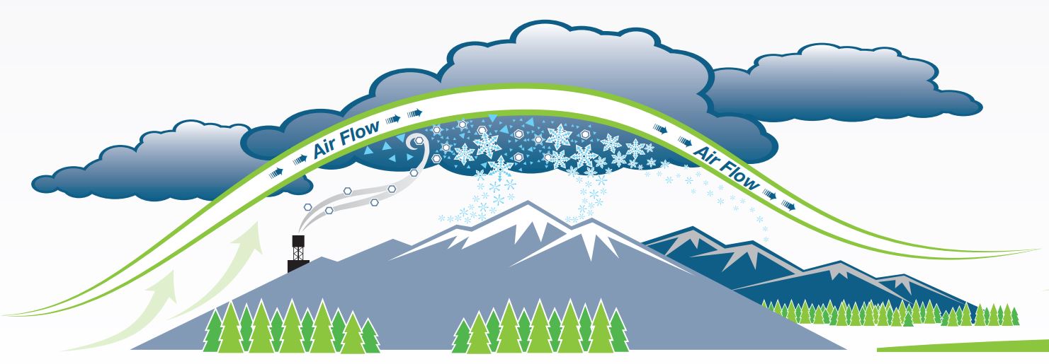
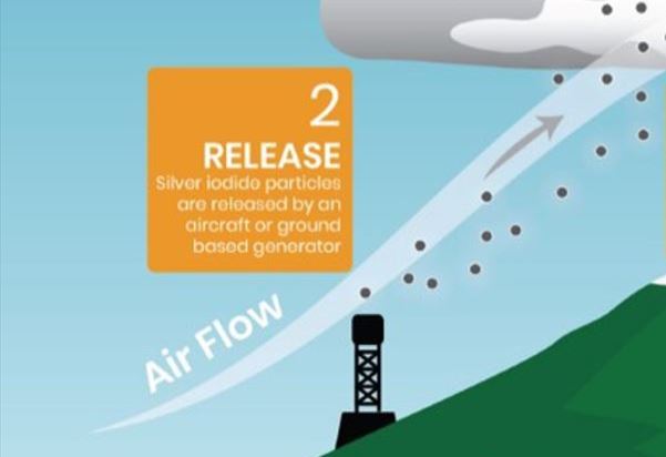
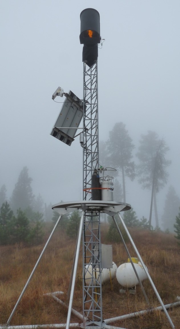
Remote Ground Generator

A remote based ground generator releases seeding material into the atmosphere and is carried by winds moving up and over a mountain, where it then reaches the cloud base to begin ice formation. This system is operated remotely during active storms. Remote operations allow for placement at higher elevation where snowpack is significantly higher. Placing generators at high elevations prevents inversion layers, or mountain flow blocking conditions, from not being able to reach the cloud.

Manual Ground Generator

A manual ground generator operates the same as a remote ground generator but must be turned on and off by a person. Manual ground generators are one of the original cloud seeding technologies and are inexpensive to operate. They must be located where they are accessible to the operator; meaning they are often situated at mid to lower elevations.

Images provided by Idaho Power Company.

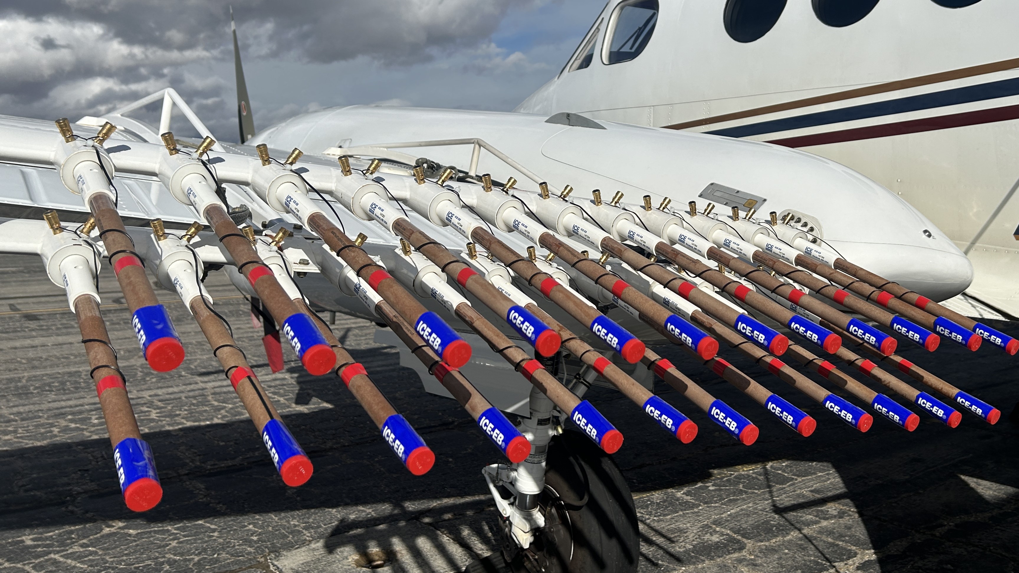
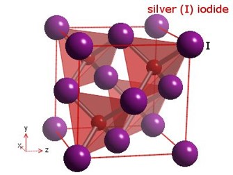
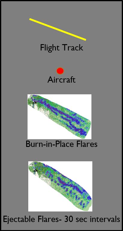
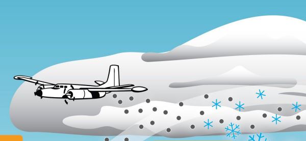
Wing Mounted "Burn-In-Place" (BIP) Flares

Burn-In-Place wing mounted flares emit a fine silver iodide smoke directly into the cloud during flight. The flares are released directly in the cloud when the plane flies through the cloud, for as long as conditions remain suitable for the aircraft safety and for seeding to occur.

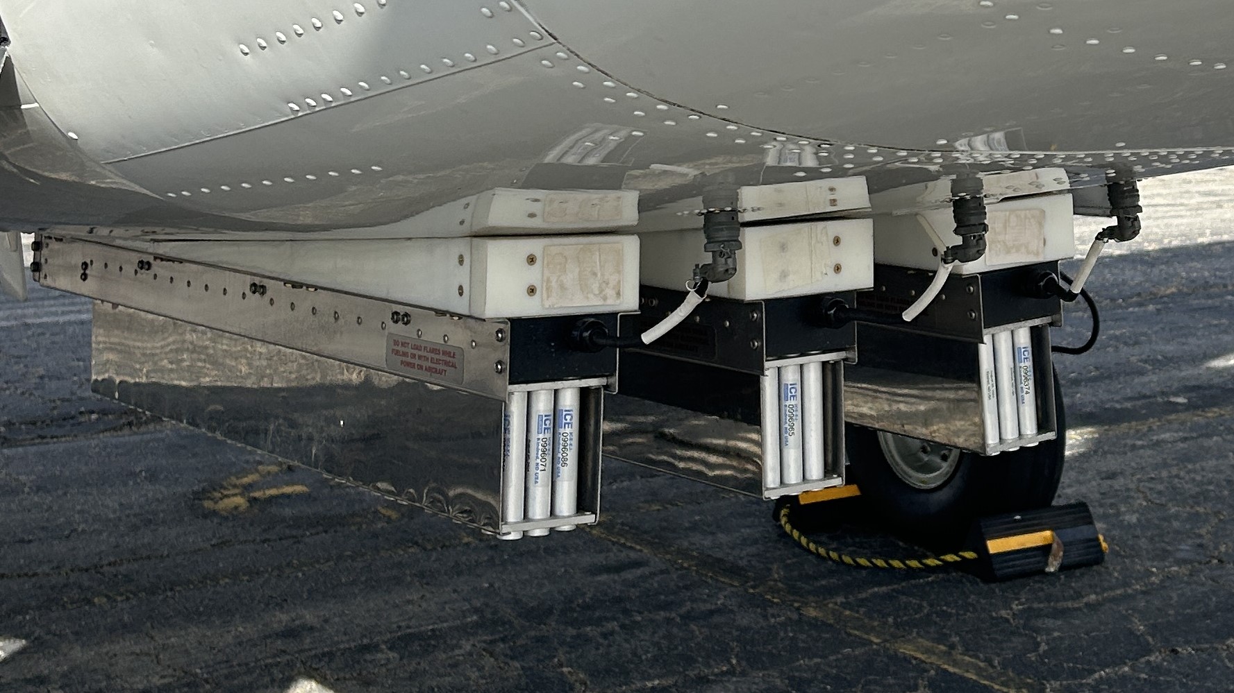
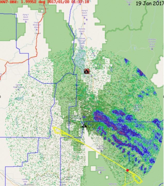
Belly Mounted Ejectable (Ej) Flares

Ejectable, belly mounted flares (EJ) are released into the cloud when the plane flies above the cloud; the aircraft drops seeding material into the cloud system by ejecting it from the belly of the plane. This is used when the conditions in the cloud present too hazardous for the aircraft and its crew.
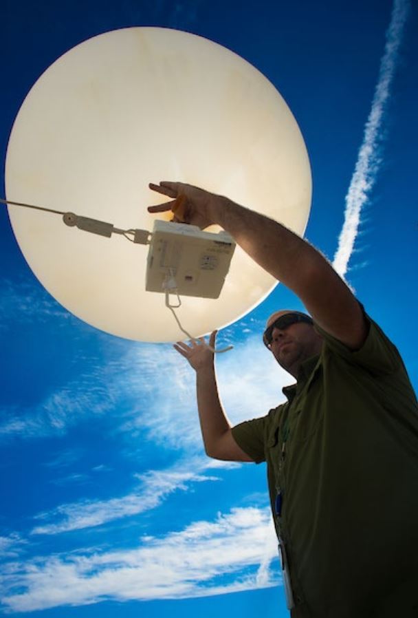
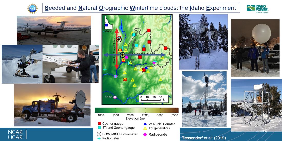
Images provided by Ice Crystal Engineering LLC.

Weather Instrumentation

Weather Balloon

Weather balloons provide meteorologists with verticals profiles of temperature moisture and winds in the atmosphere. The weather balloons are used in select locations every 12 hours.
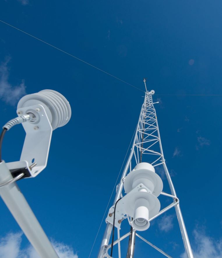
Ice Rate Sensors

Ice rate sensors provide meteorologists with real-time observations of liquid water at a point location.
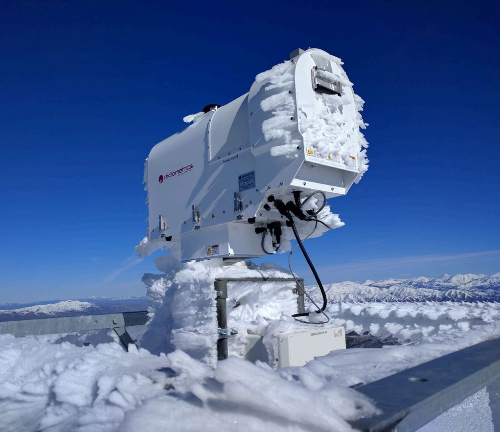
Radiometer

Radiometers provide meteorologists with real-time atmospheric water values.
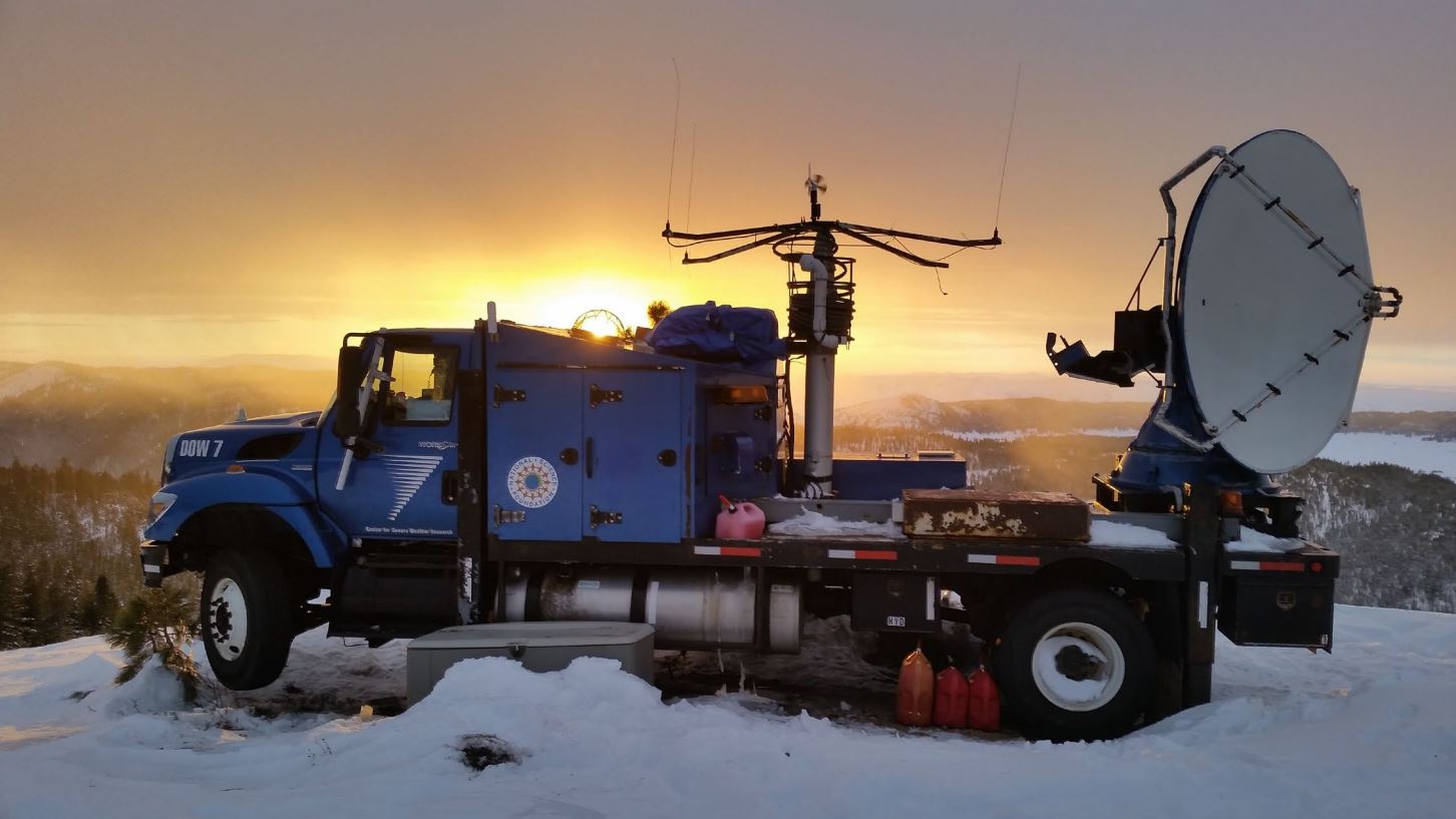
Radar

Radars detect, transmit, and receive electromagnetic waves to determine properties of objects and recognize distances of objects.
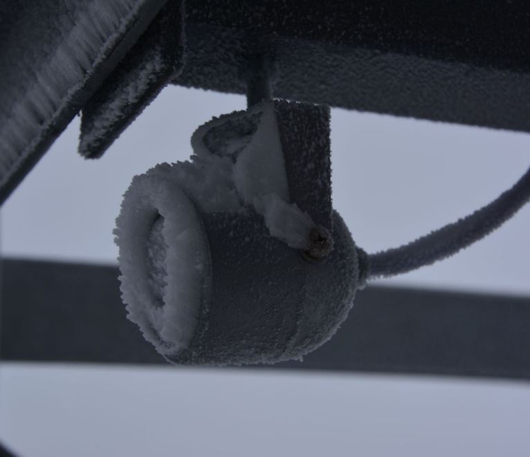
Web Cams

Web cams provide meteorologists visual confirmation of current conditions.

Precipitation Gauge

Precipitation gauges provide meteorologists with near real-time, high resolution, snow and rainfall rates and quantities.
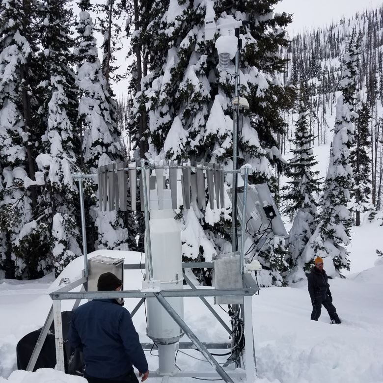
Surface Station

A meteorological surface station provides meteorologists with wind, temperature, dew point, wind speed, and wind direction values.

Images provided by Idaho Power Company.

Are condensation trails and cloud seeding the same thing?

A common misconception is that condensations trails from aircraft, otherwise known as “Contrails”, are a result of cloud seeding. Water exists in the atmosphere at all times, even when the sky appears to be clear and blue (gas form). Clouds are the existence of water in liquid form that can be seen visibly, and are the result of water converting from gas form to liquid water droplets (a physical process). 

Condensation Trails (Contrails): “create” a new cloud formation. 

Condensations trails (“contrails”) are line-shaped cloud formations produced by aircraft engine exhaust. 

Cloud Seeding: “depletes” an existing cloud formation.

Cloud seeding is the process of inputting a solid particle (nucleus) into an EXISTING cloud formation, that liquid water can formulate ice around, and essentially deplete the cloud by turning its water content into ice. When the ice crystal becomes heavy enough, it falls from the sky as precipitation, thereby reducing the cloud structure. AgI cannot trigger the physical process of water changing from gas to liquid form to create a cloud. AgI can trigger the physical process of liquid water changing to solid form (ice). 

How do condensation trails (contrails) form?

The air is considerably colder at aircraft flight altitudes, several miles above the Earth’s surface. Cloud formations develop when hot gas from aircraft exhaust collides with very cold air in the atmosphere. When the exhaust gases from an aircraft cool and mix with surrounding air containing moisture, visible liquid water is formed, and a condensation trail or “cloud formation” develops. You can refer to the EPA’s Condensation Trails FAQ sheet for more information about condensation trails.

The image above shows a condensation trail (contrail) formed by the hot exhaust from the airplane mixing with cold air in the atmosphere, resulting in the water to condense into a visible cloud formation.

The image shows car exhaust in the winter. This is the exact same process that creates fog on a window or exhaust from a car on a cold winter day. However, on the ground, there are not high enough wind speeds to create a “trail” of condensation. 

Other Resources:

Helpful Resources

Publications

Publications, brochures, reports, research, and policy statements can be found on the North American Weather Modification Council’s publication page and the Weather Modification Associations publication page.

ver: 3.5.2a | last updated:
Jump back to top of page button