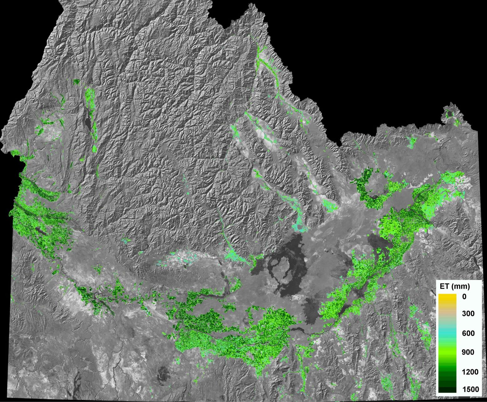
IDWR is responsible for the administration and management of Idaho waters which include the measurement and the accounting of consumptive and non-consumptive uses of water. Evapotranspiration (ET) from Idaho’s 3.4 million acres of irrigated agriculture accounts for more than 95% of the consumptive use in the state.
IDWR and the University of Idaho worked from 2000 to 2005 under a NASA grant to develop procedures to map ET from Landsat data and to apply the ET data to water resource problems. The Mapping EvapoTranspiration using high Resolution and Internalized Calibration (METRIC) energy balance model was developed to compute and map ET using Landsat images. Landsat is used because it is the only operational satellite that collects thermal data and has a pixel size small enough to map individual agricultural fields. Landsat thermal data are a critical part of the model and are needed to compute the surface temperature required in ET computations. IDWR uses Landsat-based evapotranspiration data in hydrology, water resources planning, and water administration.
