
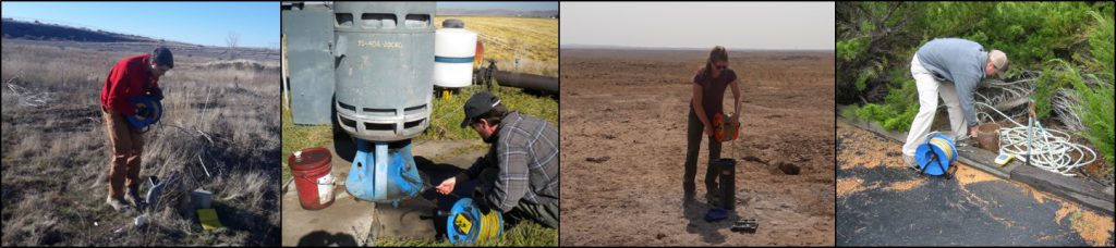
IDWR staff manually measures the “depth to water” in over 1,100 wells throughout Idaho, typically each spring and fall. In addition to the manual hand measurements, over 500 wells have been instrumented with equipment that is capable of providing near-continuous water level data that are stored in data loggers for periodic downloads. Telemetry equipment that can provide real-time data reporting is also being installed at select sites, as the technology advances.
Measuring groundwater levels in the state of Idaho is a collaborative effort. While IDWR monitors over 1,100 wells, the U.S. Bureau of Reclamation (USBR), the U.S. Geological Survey (USGS), private consultants, and other public and private entities measure over 1,200 additional wells on a regular basis. In total, over 2,300 wells are currently being monitored in Idaho.
Evaluating the Data
IDWR maintains a groundwater level database which contains the data gathered by various sources including the measurements taken by IDWR staff, USGS, USBR, IDWR contractors, plus other public and private entities. IDWR analyzes the data to determine trends in regional groundwater levels. These trends are used to:
- evaluate groundwater availability for new water uses
- evaluate and identify areas with declining groundwater levels that might need administrative action—such as groundwater management areas or critical groundwater areas
- support specific planning, modeling, and managed recharge projects in Ada County, Rathdrum Prairie in North Idaho, and in the Egin Bench, Aberdeen, and North Side Tract areas of the Eastern Snake Plain Aquifer (ESPA)
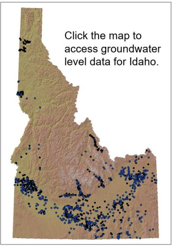
Groundwater Level Data
Use a map to find data and graphs for Idaho’s groundwater levels.
Groundwater Level Data Bulk Download
Access a bulk download of groundwater levels for Idaho.
Geothermal Resources
View Idaho’s abundant geothermal resources, both as naturally-occurring hot springs and wells.
USGS National Water Information System
Obtain data from over 19,000 sites in Idaho.
Moratorium Orders
Applications undergoing review by IDWR or being held without action because of a moratorium or administrative action.
Technical Publications
Review publications issued by IDWR and the IWRB.
Listed below are related resources for groundwater monitoring and management.