Overview
Priest Lake, Upper Priest Lake, and the Priest River lie in the northern Idaho panhandle. The lower lake stretches to within 15 miles of the Canada-US border and reaches nearly 370 feet at its deepest point. All three bodies of water draw significant tourism and recreation in the Bonner County area due to an abundance of opportunities for outdoor activities, such as camping, fishing, boating, and more.
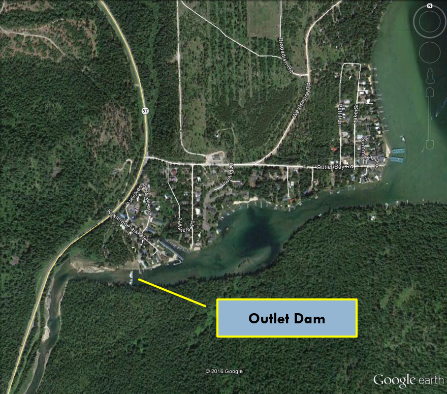
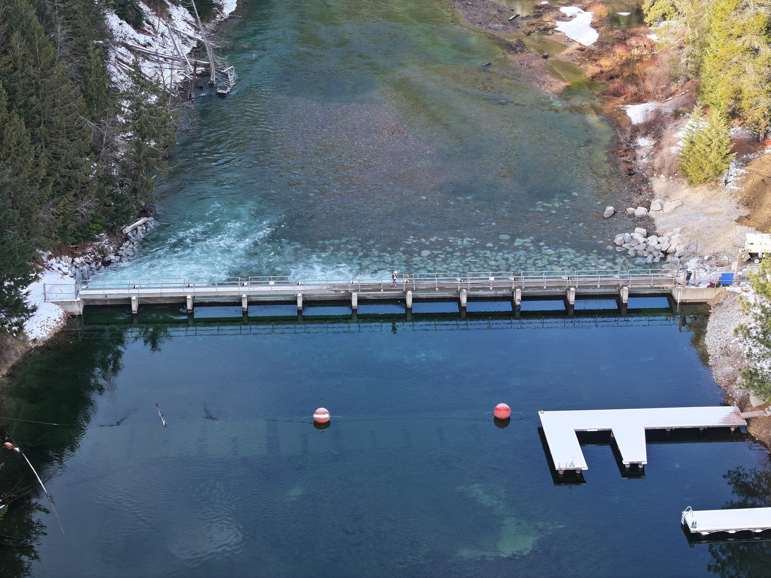
The Idaho Water Resource Board currently owns and operates the Priest Lake Outlet Dam, which is located on the southern tip of Priest Lake. The dam functions to control the lake level and Priest River flows. In 2015, limited water supply and drought conditions in northern Idaho made maintaining the balance between the Priest Lake water level and downstream flow difficult. This situation, coupled with concerns about the breakwater structure and Thorofare access issues, increased interest in developing both operational and engineered improvements to the entire system.
In response to area stakeholders’ concerns, the IWRB authorized funding to perform an evaluation of strategies and options that could meet the long-term water management solutions for the Priest Lake and Priest River system.
About the Priest Lake Outlet Dam and Thorofare
The Priest Lake Outlet Dam is a 1978 structure that controls the flow of water from Priest Lake into the Priest River. The dam was originally built by the Idaho Department of Water Resources, but legislature in 2017 transferred supervision and operational control of the dam to the Idaho Water Resource Board.
The dam is 194 feet wide and uses eleven Tainter gates to control the flow of water from Priest Lake into the Priest River. Each steel Tainter Gate is 16 feet wide and 7 feet tall. The gates sit atop a 3-foot concrete slab referred to as the old dam apron. Above the Tainter gates is a walkway that allows operators to access and adjust the Tainter gates. Beneath the old dam apron is a 20-foot-deep steel sheet pile wall that prevents water from flowing under the dam.
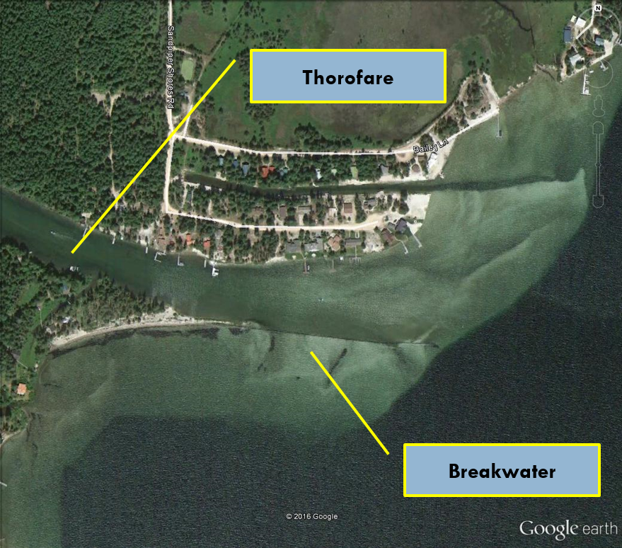
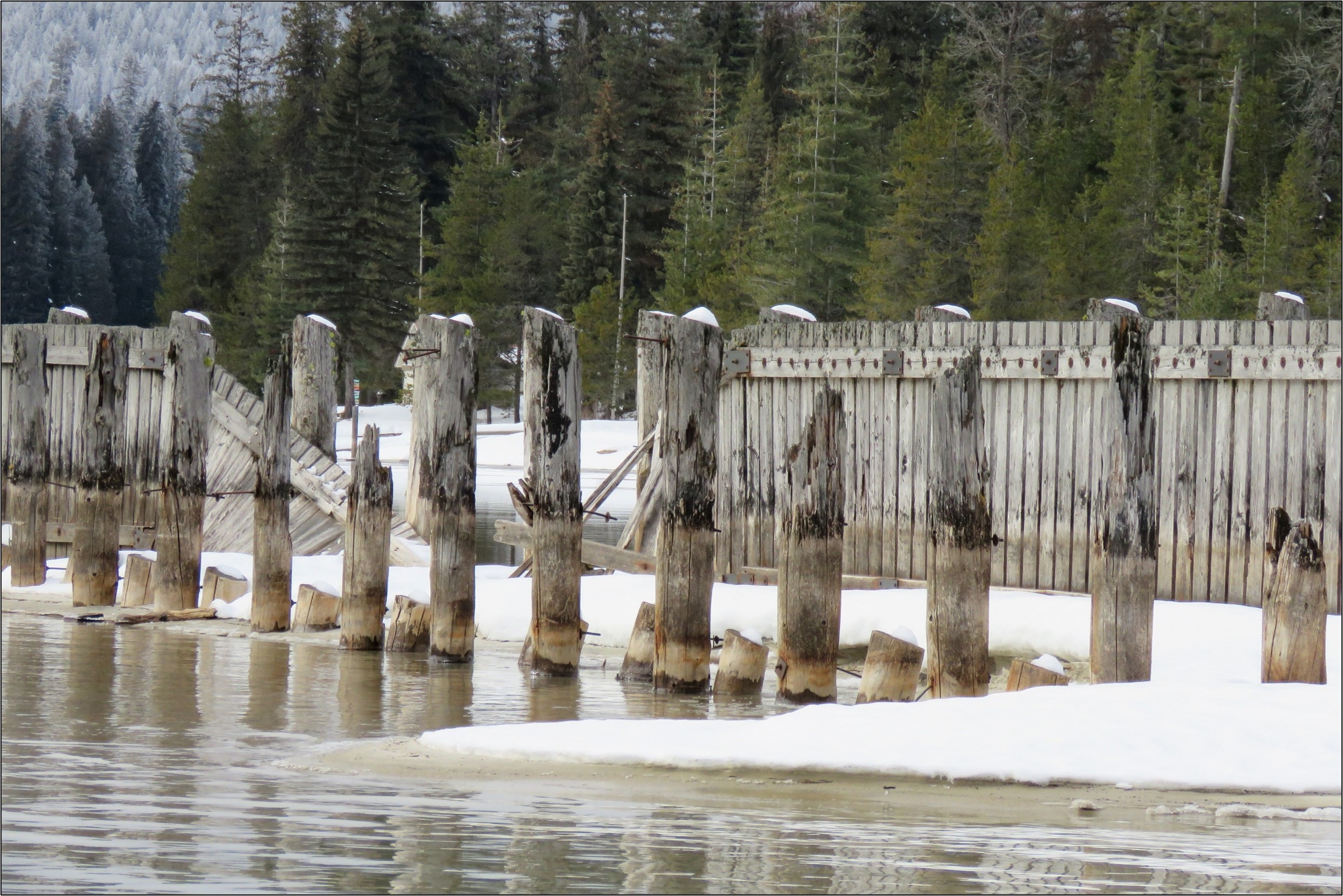
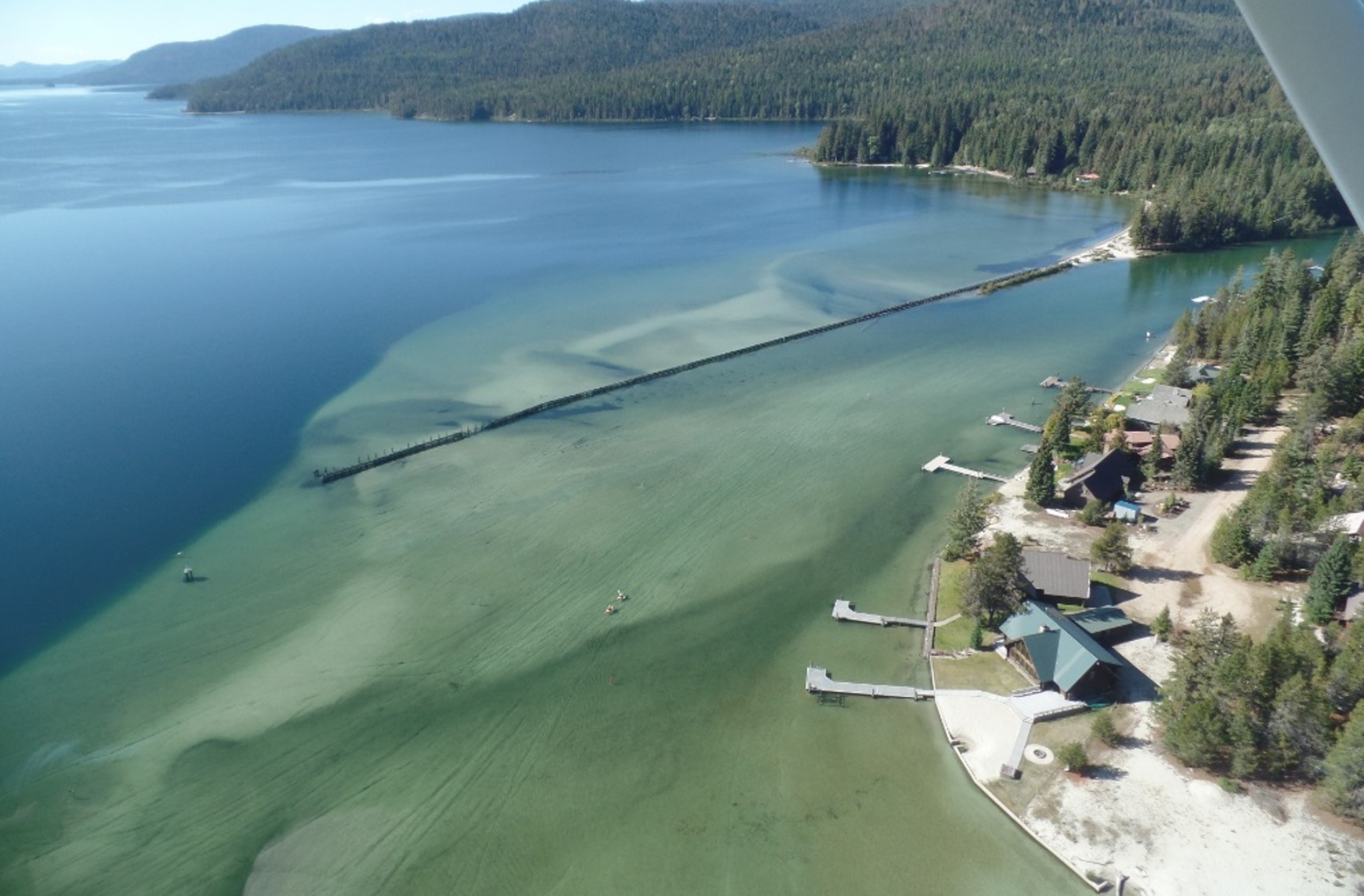
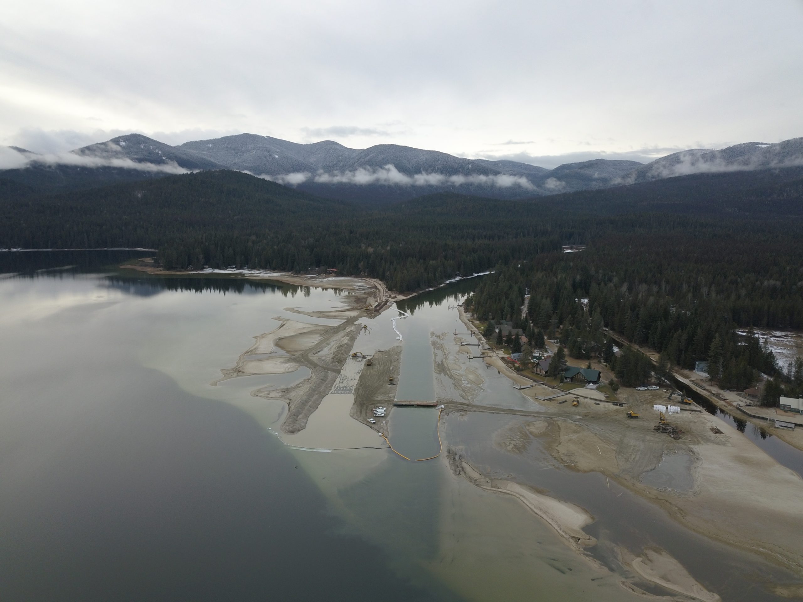
The Thorofare is where the Priest River, flowing from the Upper Priest Lake, joins Priest Lake. The area is popular with boating traffic and by 2015, access had become difficult due to sedimentation buildup and a deteriorating breakwater structure.
A Necessary Overhaul of the Dam
Idaho Code Title 70-507 requires the Board to operate the dam so that lake levels are maintained within a very narrow range. It was determined that increasing dam height by 6 inches would allow better control of lake levels while allowing more water to flow into the Priest River during dry summer months. The Board contracted with the engineering firm of Mott MacDonald to study the feasibility of raising the dam and to recommend any additional repairs or improvements that could improve the functionality of the dam and extend its service life. The study was completed during the Spring of 2018.
The 2018 Study recommended increasing the dam’s height by attaching a 16-foot-wide extension plate to the top of each Tainter gate. The 2018 Study also found that the dam did not meet current standards for stability, and that under certain conditions, pressure exerted by the lake might cause the dam to slide. To increase dam stability, the 2018 Study recommended adding additional structural elements that would help the dam better resist sliding. In 2019, Mott MacDonald was awarded a contract to design the necessary modifications to the dam. During the design phase, Mott MacDonald recommended additional improvements including the installation of three piezometer gauges to monitor pressure beneath the dam.
Dam Stability
The Priest Lake Outlet Dam is classified by the U.S. Army Corps of Engineers as a gravity dam. Simply put, nothing other than the weight of the dam holds it in place. The old dam apron is a 3-foot-thick rectangular slab that rests directly on the bottom of the Priest River. There are no additional anchors or other foundational elements holding it in place.
In normal operation, the pressure of lake water acting on the upstream side of the dam exerts a lateral sliding force that is resisted only by the frictional forces between the bottom of the slab and the soils of the Priest River. These soils consist primarily of sand and gravel through which water can easily percolate. This water can exert upward pressure on the bottom of the dam slab (pore pressure), thereby decreasing the frictional forces holding the dam in place and possibly allowing the dam to slide. Just a few inches of sliding could be catastrophic.
A 20-foot sheet pile wall, installed beneath the dam in 1978, is intended to prevent the flow of water beneath the dam, thereby preventing lakeside water pressure from exerting an upward force on the old dam apron. Being fabricated from steel, the sheet pile wall is likely to corrode and eventually will no longer be able to stop the movement of water underneath the dam. Unfortunately, there is no way to inspect the sheet pile wall, and even if there were, it would be practically impossible to either repair or replace it.
Addressing the Issue
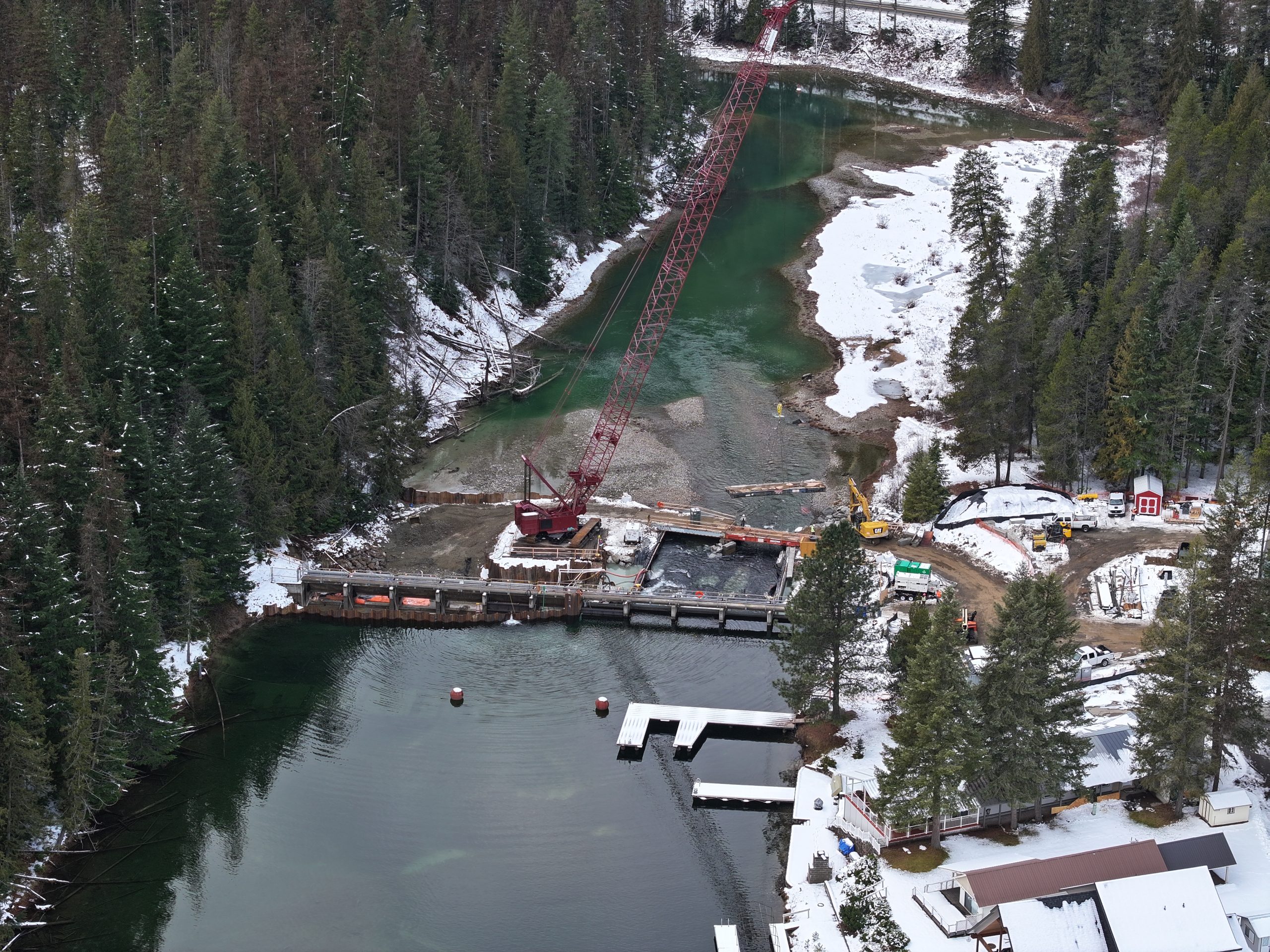
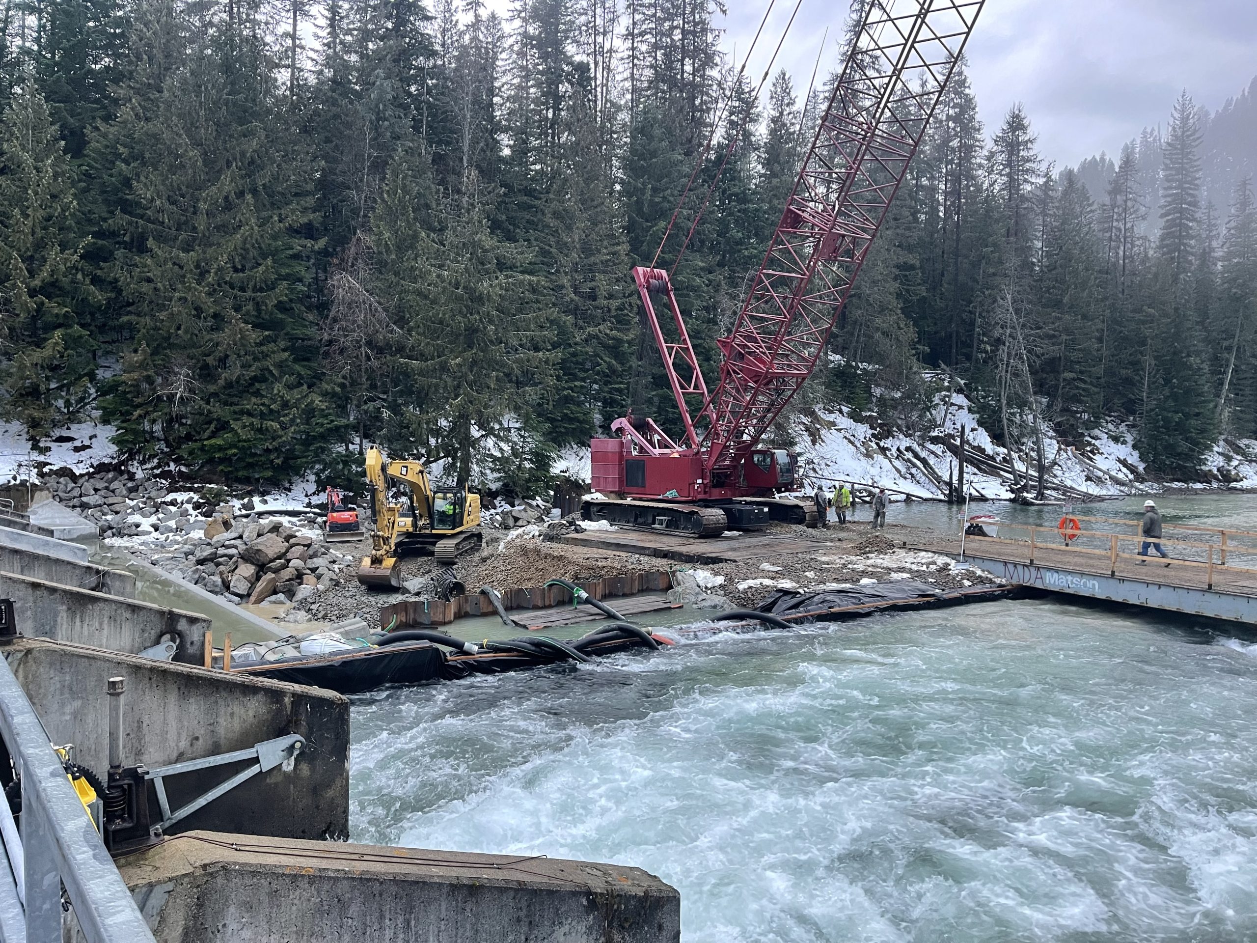
To keep the dam from moving, Mott MacDonald recommended in their 2018 Study to add two new structural features to help lock the dam in place: a concrete apron extension and a field of armor stone. Over 4 phases of construction, these improvements (along with the gate extension) were completed in 2024. More information can be found on the Construction page.
The concrete apron extension lies downstream of the original structure and is a new slab that extends the full width of the dam, thereby increasing the weight of the apron system and its frictional resistance to the lateral force of the lake acting on the dam. To preclude the build-up of pressure beneath the new slab, it is underlain by a coarse gravel “drainage stone.” A series of perforated pipes beneath the new slab permit the flow of water from the drainage stone into the river. A keyway – a 4-foot-deep concrete wall extending beneath the apron into the riverbed – helps lock the new slab in place.
The armor stone consists of large angular stones placed at the downstream edge, or toe, of the apron extension. These stones are carefully placed against the slab and keyway so that they interlock and provide additional resistance against sliding.
Modeling conducted by Mott MacDonald concluded that these new features would lock the dam in place under every foreseeable combination of lake, groundwater, and river level variations.
Project Phase 1: Priest Lake Management Study
The Priest Lake Water Management Study was completed in February 2018. The study included the following recommendations:
- Dredging a portion of the Thorofare channel and replacing the current existing porous breakwater structure with an impervious sediment retention feature.
- Temporarily raising the surface level of Priest Lake three to six inches during the recreational season of dry years and integrating real-time streamflow data to allow more operational flexibility.
- Outlet structure improvements to the scour apron, modifying and strengthening gates, and electrical gate operation.
Project Phase 2: Preliminary Engineering & Design
The work of Phase 2 was a continuation of the work, conclusions, and recommendations outlined in the Phase 1 report. Phase 2 project goals included managing lake levels (maintaining a three-foot level at the USGS outlet gage during the recreational season and developing lake level operational strategies during dry and low water years), maintaining minimum flow requirements downstream of the outlet dam, and providing sustainability for the Thorofare (promoting self-sustaining improvements to improve Thorofare access and navigability). Phase 2 for preliminary engineering design of the Outlet Thorofare and the Priest Lake Outlet Dam was completed in 2019.
Project Phase 3: Engineering Design & Preparation of Construction Documents
Phase 3 involved performing engineering analysis and preparation of construction documents needed for construction. This phase was completed in 2020 for both the Outlet Thorofare and the Priest Lake Outlet Dam.
Project Phase 4: Construction Improvements
The work of Phase 4 concerned the construction of both the Outlet Thorofare and the Priest Lake Outlet Dam.
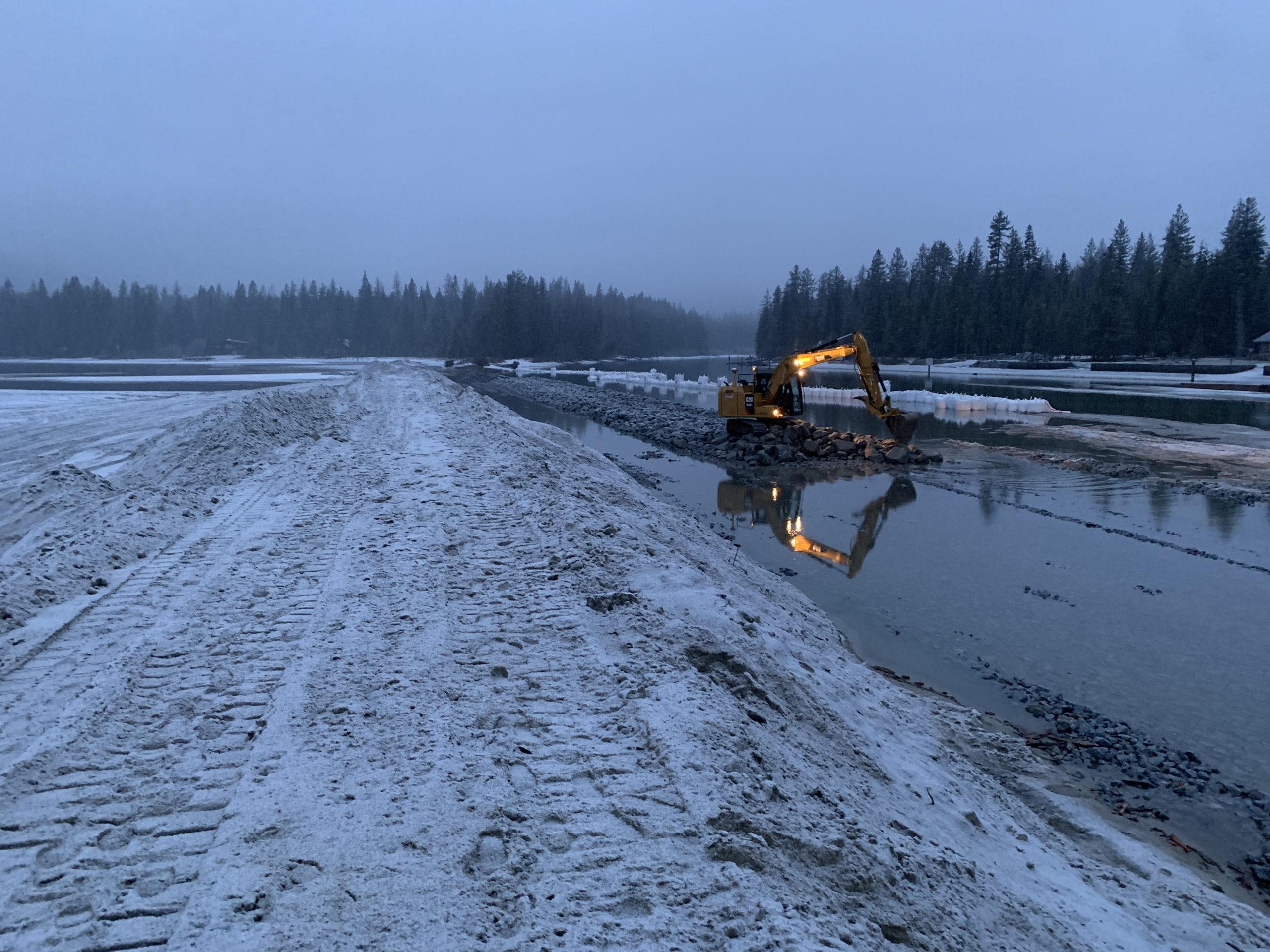
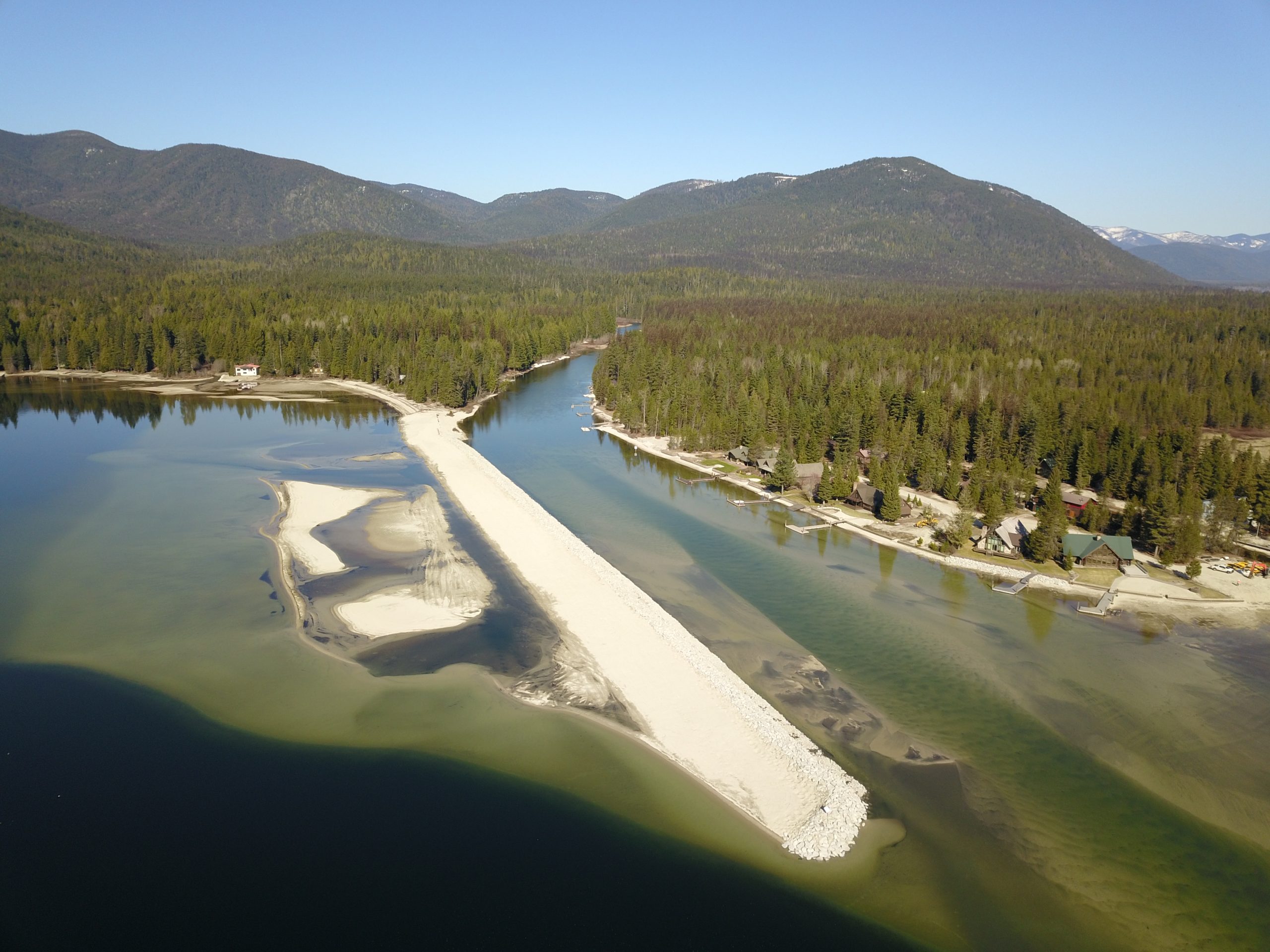
The Outlet Thorofare construction was successfully completed during the winter of 2020/2021. This project created an impervious sediment retention feature to replace the original breakwater structure and involved dredging the silted-in channel.
At the Outlet Dam, construction was completed in 2024. Each of the eleven Tainter gates were fitted with a six-inch extension. Structural improvements included the installation of a concrete apron downstream of the existing structure. Underneath the apron, vibrating wire piezometers were installed to monitor subsurface pressures. Directly downstream of the new apron, armor stones were placed to provide additional lateral support and erosion control. These improvements help to safely raise the lake level when needed and add structural reinforcements that increase the Outlet Dam’s operational longevity.
What was the purpose and objective?
- Thorofare channel: maintaining vessel access between Upper Priest Lake and Priest Lake.
- Priest Lake Outlet Dam: Preserving lake levels through the main recreation season and maintaining Priest River flows during years of drought. This goal supports the local economy and meets current lake level and river flow requirements.
What is the background and state law establishing the 60 cfs minimum discharge from the Priest Lake Outlet Dam?
Upon construction of the Priest Lake Outlet Dam in 1950, the State of Idaho and Northern Lights, Inc., the operator of the dam, executed an operations and maintenance agreement which stipulates that the minimum discharge from the Priest Lake Outlet Dam during the recreation season shall be 60 cfs. Since the execution of the operations and maintenance agreement, IDWR has operated the dam to meet the minimum discharge flow of 60 cfs.
What is the background on the statutory water rights at Priest Lake?
In 1927, Water Right License No. 16642, which was amended to Water Right 97-2020, was issued to the State of Idaho for preservation of the Priest Lake water for scenic beauty, health, and recreation purposes necessary and desirable for all inhabitants of the State. The priority date for the water right is January 24, 1927, with a beneficial use designation of “Recreation Storage,” with a storage volume of 800,000 acre-feet. As stated in the original license, the 800,000 acre-feet is needed to maintain the level of Priest Lake not higher than normal high-water stage and not lower than the natural low-water stage at any season of the year.
What did the 2018 Study include?
The Priest Lake Water Management Study was initiated by the IWRB to evaluate opportunities for improving operation of the Priest Lake (also known as Lower Priest Lake) and Priest River system. The study includes several action items.
- Evaluation of alternatives for maintaining required recreational lake levels and maintaining current minimum discharge requirements downstream of the Priest Lake Outlet Dam (60 cfs).
- Assessing potential structural and operational modifications to the dam.
- Analyzing options to improve access and navigable conditions for the Priest Lake Thorofare.
Where was the study area?
Priest Lake is approximately 18 miles long, has a maximum depth greater than 350 feet, and has an active storage capacity of approximately 800,000 acre-feet. It is connected to Upper Priest Lake (which is approximately 3.3 miles long) by a three-mile-long channel known as the “Thorofare,” which has long been used by the public for recreation and access to the upper lake. A 1,400-foot-long timber breakwater at the north end of Priest Lake is intended to manage sediment from the upper lake while providing wave and erosion protection to landowners at the north end of Priest Lake.
The original Priest Lake Outlet Dam was constructed in 1950 to maintain lake levels in Priest Lake and manage downstream flows into Priest River. The current dam, which was constructed in 1978, is owned by IWRB and operated by a contractor on behalf of the Board. The dam is approximately 12 feet high with 11 gates that regulate discharge. It does not have an emergency spillway.
Is the cold-water bypass concept part of the Priest Lake Water Management Study?
No. This concept has been evaluated by Idaho Fish and Game and has received mixed public sentiment. The proposed concept would likely cost more than $10 million and there are no current plans to construct a bypass.